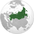
Файл:Union State (Crimea and eastern Ukraine disputed).svg

Размер этого PNG-превью для исходного SVG-файла: 541 × 541 пкс. Другие разрешения: 240 × 240 пкс | 480 × 480 пкс | 768 × 768 пкс | 1024 × 1024 пкс | 2048 × 2048 пкс.
Исходный файл (SVG-файл, номинально 541 × 541 пкс, размер файла: 442 Кб)
История файла
Нажмите на дату/время, чтобы увидеть версию файла от того времени.
| Дата/время | Миниатюра | Размеры | Участник | Примечание | |
|---|---|---|---|---|---|
| текущий | 13:25, 24 февраля 2023 |  | 541 × 541 (442 Кб) | Stjn | Reverted to version as of 21:56, 3 October 2022 (UTC): although Kuril Islands are also disputed, they don't have the same level of significance as occupied territories of Ukraine, so it's better to keep a separate map with them for that use case |
| 02:59, 13 февраля 2023 |  | 536 × 537 (440 Кб) | Jamie Eilat | Changed color of disputed Kuril Islands dispute to match the disputed annexation of east Ukraine. | |
| 21:56, 3 октября 2022 |  | 541 × 541 (442 Кб) | Jazzertyy | Uploaded own work with UploadWizard |
Использование файла
Следующая страница использует этот файл:
Глобальное использование файла
Данный файл используется в следующих вики:
- Использование в ast.wikipedia.org
- Использование в bg.wikipedia.org
- Использование в ca.wikipedia.org
- Использование в fi.wikipedia.org
- Использование в fr.wikipedia.org
- Использование в he.wikipedia.org
- Использование в ru.wikipedia.org
- Использование в sv.wikipedia.org
- Использование в vi.wikipedia.org
- Использование в www.wikidata.org